The Chief Executive of Network Rail, Andrew Haines, recently stated that climate change presents “the biggest challenge” facing British railways today and in the near future. The rail infrastructure owner announced a £2.8bn spending injection over the next five years for measures to help the public rail body cope with the effects of extreme weather conditions on the British railway network.
A glance at data helps to understand the magnitude of the challenge posed by climate change to the UK’s rail network. According to a new study by World Weather Attribution, the average precipitation on stormy days in the UK has already become approximately 30% more intense due to steady increases in global temperatures.
Along with these changes, railways are facing more service disruptions related to track shifts, rail embankment failures, landslips, and damage to supporting infrastructure such as bridges and tunnels. Increased ground moisture creates conditions for soil and earthworks movement that negatively impacts rail services.
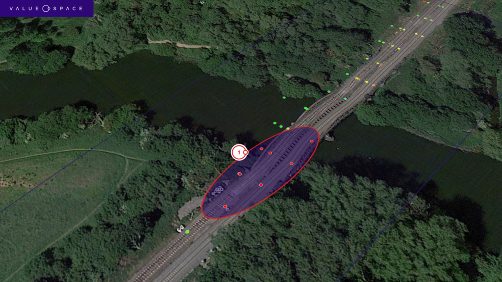
The closure of Nuneham Rail Viaduct in Oxfordshire last year was an example of such structural challenges. Network Rail suspended rail traffic on the busy mainline having detected movement on the viaduct’s South bank abutment supporting the bridge. It took 10 weeks of emergency repairs before the track could re-open.
Would there have been a way to identify developing movement issues ahead of time and take proactive action at Nuneham? Satellite-based analysis of the viaduct revealed that notable movement at the exact location where the issues led to major repairs in 2023 would have been detected in early 2021 – two years ahead of the actual disruption.
Satellite-based solutions
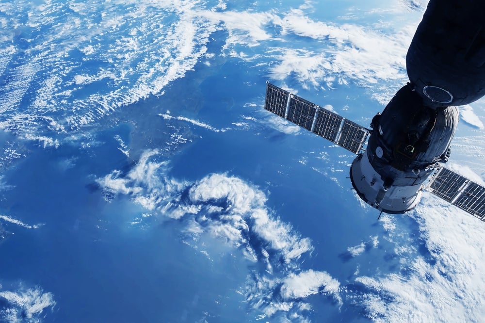
Satellite-based radars scan the earth’s surface, including manmade infrastructure objects, for millimetre-scale movements every two weeks. They pick up existing or developing signs of movements on slopes, track bed, and supporting rail infrastructure that allows engineering teams to identify, monitor, and quantify the risks posed by climate change on infrastructure networks in almost real-time.
Access the most comprehensive Company Profiles
on the market, powered by GlobalData. Save hours of research. Gain competitive edge.

Company Profile – free
sample
Your download email will arrive shortly
We are confident about the
unique
quality of our Company Profiles. However, we want you to make the most
beneficial
decision for your business, so we offer a free sample that you can download by
submitting the below form
By GlobalData
It is a cost-effective way to monitor hundreds or thousands of miles of rail network, and with its historic data timelines going back for ten years, it can inform rail engineers of sites and locations where movement may need to be checked on-site.
This saves costs, by helping to deploy engineering and investment resources where they matter most and ensuring the resilience of rail services.

Indeed, satellite-based monitoring is already widely utilised by insurance companies to monitor critical national infrastructure assets, such as dams and mines, to identify similar potential issues ahead of time.
These challenges for rail infrastructure managers are of course not unique to the UK. Climate change is clearly a global issue, and we are seeing widespread disruptions to the rail networks in other parts of the world as well.
Scanning LOSSAN
California has seen two consecutive winters with record-breaking rainfall in the US. Value.Space recently conducted an in-depth study of the 351-mile Los Angeles–San Diego–San Luis Obispo rail line in Southern California, known as the LOSSAN rail corridor. This is the second busiest intercity passenger rail corridor in the US, connecting San Diego through Los Angeles to San Luis Obispo in California’s Central Coast region.
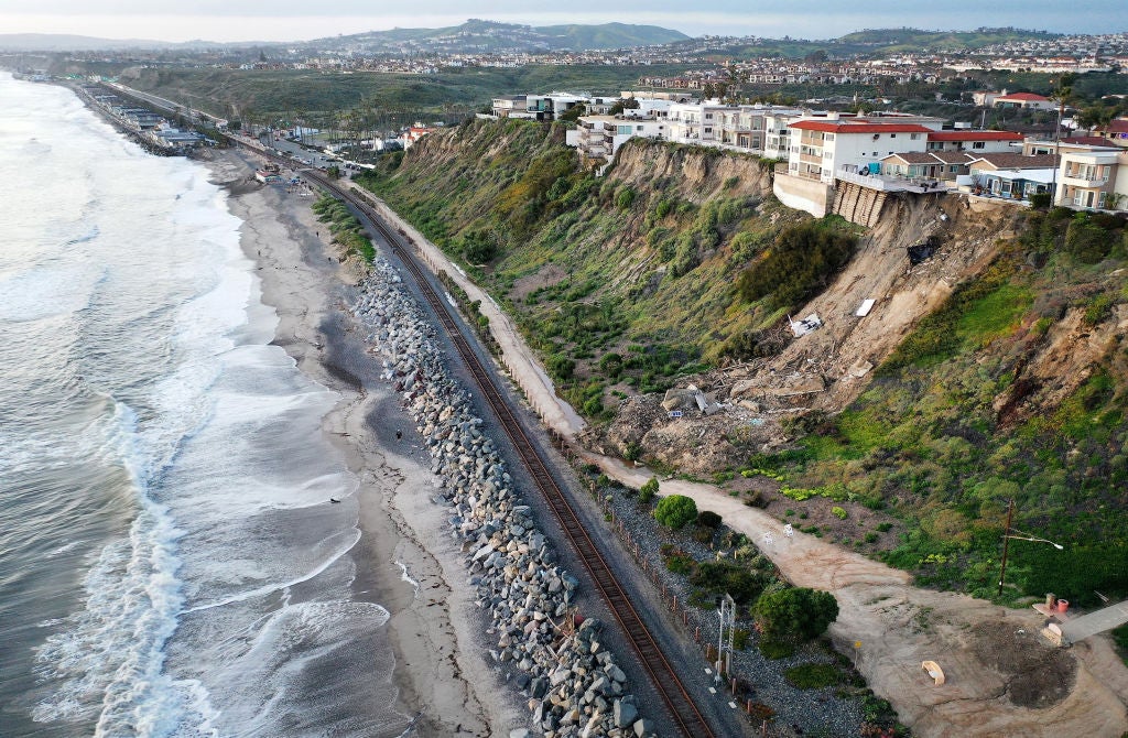
In April 2023, a major landslide blocked rail service on a stretch of the LOSSAN rail corridor running on the coastline in San Clemente, California. Emergency works for the complete re-opening of the line took several months and the losses from service disruption ran into millions of dollars.
However, satellite-based movement surveys of the landslide area identified typical signs of a developing landslide forming on the slope six months before the incident took place.

There are other sections of the corridor that have been impacted by ground movement and suffered severe service disruptions over the past few years.
Spaceborne movement surveys of these locations consistently show that satellite monitoring would have helped to detect warning signs ahead of time for movements that disrupted services or map out current movements on track sections that are known for being vulnerable to erosion or landslides.
We can see therefore why the adoption of technologies such as satellite-based monitoring for enhanced risk assessment should become a crucial tool for rail network managers.
Thanks to its highly accurate and up-to-date deformation detection capabilities, satellite-based technology is well-placed to identify, monitor, and quantify climate change risks, aiding rail networks in the fight against increasing disruptions caused by more extreme weather patterns.

