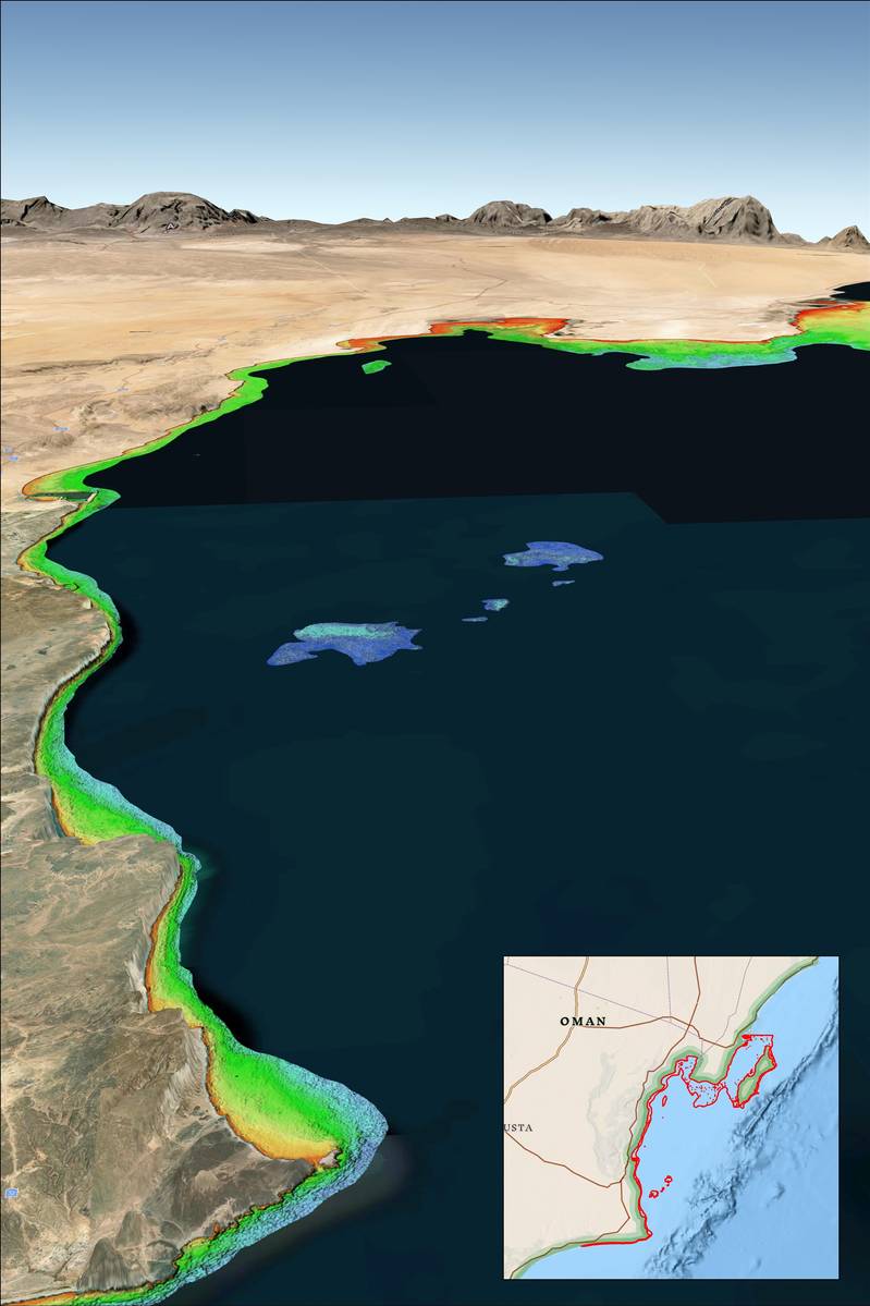
Recent incidents of naval and commercial vessels running aground have underscored the inherent risks of operating in shallow and poorly charted coastal waters. A solution from Denver-based TCarta Marine utilizes Earth observation satellites to deliver precise water depth measurements in near-shore areas.
“While the exact causes of recent ship groundings off the coasts of Oman, Greenland, and Fiji are under investigation and often complex, the risk of such accidents can be significantly reduced with up-to-date bathymetric data produced from satellite imagery,” said TCarta President Kyle Goodrich. “Often in coastal areas, the regions outside commercial shipping lanes are poorly charted or not surveyed.”
Traditionally, obtaining high-quality water depth measurements in shallow coastal waters has been both costly and hazardous, particularly in remote or contested regions. Goodrich noted that the growing presence of military vessels and eco-tourism charters in unfamiliar areas only heightens the risk of maritime accidents.
For over a decade, TCarta has been providing marine charting organizations with essential water depth data through a technique known as Satellite Derived Bathymetry (SDB). This method employs advanced physics-based algorithms to analyze optical imagery from commercial remote sensing satellites, measuring the light reflected from the seafloor to determine water depths. Depending on water clarity, SDB typically achieves accuracy up to depths of 20 to 30 meters.
“In addition to posing no danger to personnel, equipment, or coastal environments, satellites are more cost effective than ship-borne sonar or airborne laser scanning because they acquire image data over large regions in seconds,” said Goodrich. “And because satellites orbit without geographic restrictions, data can be collected for areas otherwise off limits to vessels or aircraft.”
To date, TCarta has successfully mapped nearly one-third of the world’s coastlines using SDB, providing both custom and off-the-shelf data products. The custom datasets utilize high-resolution satellite imagery to identify seafloor features like shoals and reefs with one-meter resolution. Meanwhile, the Global Satellite Derived Bathymetry (G-SDB) product offers 10-meter detail, making it an excellent resource for spotting coastal shoals in remote regions that do not appear on existing nautical charts. Large contiguous G-SDB products are readily available for critical areas, including the South China Sea, Arabian/Persian Gulf, Gulf of Oman, Red Sea, Black Sea and Eastern Mediterranean.

