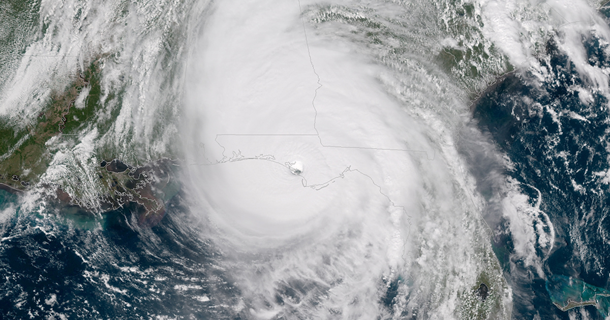
Hurricanes are massive, complex systems that can span hundreds of miles as they swirl around the low pressure of the storm’s eye. In such a complicated situation, predicting how powerful a hurricane will grow is a difficult undertaking.
A new collaboration between researchers in South Korea and Florida State University is improving hurricane forecasting by incorporating the effects of sea spray into the models that predict hurricane behavior. The work was published in Environmental Research Letters.

“We know forecasts predicting hurricane tracks are pretty good most of the time, but the intensity forecasts have traditionally not been as good, and we’re trying to figure out why,” said Mark Bourassa, a professor in the FSU Department of Earth, Ocean and Atmospheric Science and paper co-author.
As hurricanes churn through the ocean, wind and waves at the surface disperse droplets of water into the air, known as sea spray. As these droplets of warm water evaporate, they cool while releasing heat and moisture into the atmosphere near the ocean surface. The heat lifts more moisture-laden air, a process that powers hurricanes.
The researchers looked at data from probes dropped by hurricane hunter airplanes and found there was a lot more thermal energy being transferred from the ocean into the air than they expected. That pointed to a potentially overlooked feature that was influencing storm intensity.
Previous studies into the role of sea spray in hurricane intensification relied on proxy measurements such as wind speed to approximate how sea spray reduces drag, which also increases the intensity in modeled storms. But those simplifications didn’t capture how spray increased the energy fueling storms, especially for wind speeds greater than 20 meters per second.
The weather model used by South Korean and FSU researchers included a wave model to provide greater accuracy for sea spray production and incorporated changes in the heat and moisture transferred to the atmosphere.
“It’s an amazing amount of energy that we’ve been missing in these storms,” Bourassa said. “When we incorporated data showing how sea spray changes the flow of heat and moisture in a storm, we found that intensity forecasts were remarkably better than they were when we ran the same model without that single change.”
To validate their findings, the research team analyzed four major Atlantic Ocean hurricanes — Ida (2021), Harvey (2017), Michael (2018), and Ian (2022) — which caused significant damage in the United States. With the help of colleagues in Korea, they also examined four Pacific Ocean typhoons.
Existing science is typically reliable at predicting a hurricane’s path, but meteorologists want to refine their modeling to better understand and forecast the intensity of storms. This research suggests that operational models could be modified to provide better intensity forecasts.
Future research motivated by this paper could focus on rapid intensification of storms, Bourassa said, helping to add another piece to the complicated puzzle that is hurricane forecasting.
Research team members from FSU were Chaehyeon Chelsea Nam, an assistant professor in the Department of Earth, Ocean and Atmospheric Science; DW Shin and Steven Cocke, research scientists at the FSU Center for Ocean-Atmospheric Prediction Studies; Sinil Yang of the APEC Climate Center, Republic of Korea; Dong-Hyun Cha of Ulsan National Institute of Science and Technology; and Baek-Min Kim of Pukyong National University, Republic of Korea.
This research was supported by the Korea Hydrographic and Oceanographic Agency, the Ministry of Oceans and Fisheries of Korea, the Korea Environment Industry & Technology Institute, Korea Ministry of Environment, the National Research Foundation of Korea, and the Korea Meteorological Administration Research and Development Program.

