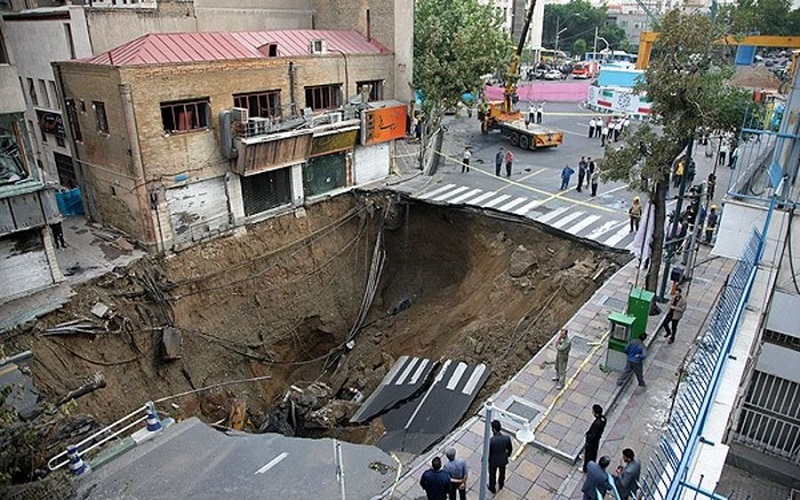
Ali Javidaneh, the head of the Iranian regime’s Mapping Organization, has raised concerns about the situation of land subsidence in Iran, stating that this phenomenon is nearing urban areas and the country’s infrastructure.
According to the state-run ILNA news agency, Ali Javidaneh stated on May 11 that the issue is not the rate of subsidence but rather that subsidence is like a ticking time bomb, and even a rate of two centimeters of subsidence per year could pose a challenge.
He mentioned that the images related to cracks or collapses of roads and streets represent the external appearance of subsidence, but subsidence occurs deep within the ground, and there are events happening that may not have signs at the surface.
According to Javidaneh, the Mapping Organization has sent maps of subsidence zones to responsible authorities, and these authorities should be accountable for why they are not using this information for planning and action.
In recent years, numerous reports of sudden land subsidence in streets and residential areas in several cities in Iran have been published.
Experts consider the uncontrolled extraction of groundwater to be one of the main reasons for land subsidence.
The situation of land subsidence in some provinces, including Tehran, Alborz, Isfahan, Fars, Kerman, Hamadan, Semnan, Qazvin, Khorasan Razavi, North Khorasan, and Yazd, has been described as critical.
Among them, Isfahan province has been one of the most vulnerable, to the extent that even the historic center of Isfahan and its ancient schools and buildings have experienced subsidence in recent years.
The phenomenon of land subsidence, which encompasses many of Iran’s plains, has not only caused damage and destruction to historical buildings but has also affected the lives of millions of people. According to experts, it will lead to financial losses and even loss of life in the not-so-distant future.
Land subsidence in some areas of Iran is up to 100 times more than global standards.

